Google Earth is a computer program that shows the virtual terrestrial globe allowing us to visualize the cartography of the planet. This is possible, thanks to satellite photography. The Google Earth map build a virtual map with the help of images obtained by satellite images, aerial photography as well as geographic information.
Google Earth allows users to zoom any building, street, and place. Launch in 2001, now it is available as an App and can be installed on Android phones.
Best Free Google Earth Alternatives in 2020
No doubt that Google Earth is a good tool but there is similar software available. Below, I have listed some of the best yet free alternatives to Google Earth. Check this out and let me know which tool you like the most.
Quick Overivew
Google Maps
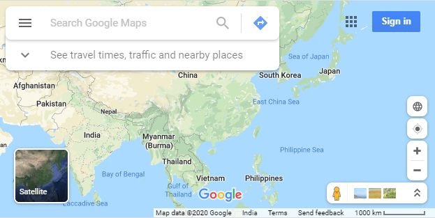
It is easy to use and has many tools to offer that have made it a current reference to quickly consult any place in the world. Google Maps works by superimposing satellite view photographs as well as from street-level panoramas made by the famous Google vehicle – Street View. In this way, with Google Maps it is possible to navigate virtually any street in the world.
Key Features
- With Google Maps it is possible to navigate virtually any street in the world and perform movements 360 degrees horizontally and 290 degrees vertically.
- The user can search how to get from one point to another and Google Maps itself tracks the fastest route.
- It shows three options, on foot, by car or by public transport.
- It allows you to search the geographical position of sites quickly and easily, showing the user how to get there.
- When you click on a place, Google Maps shows reviews, reviews, photographs, contact numbers, etc.
Price: Free
OpenStreetMap

OpenStreetMap is a community of collaborators who strive to create a world map of free access, and open to the collaboration of any person, in which we will find varied information on streets, roads, railways, trails, services, etc. With these characteristics, an alive and very updated map is achieved, which although it may not seem so, it has a large number of collaborators in all countries of the world.
Also check: 11 Best Free Conference Call Service in 2020
Key Features
- Bikemap is a map that allows us to discover, create and share bike tours through our city.
- OpenWeatherMap is an interactive weather map.
- OpenSeaMap is a huge international nautical database. It is aimed at both professional or amateur navigators and tourists looking for shops or restaurants in port areas.
- Org is a map of places accessible to people who move around in a wheelchair.
- It offers greater customization possibilities. There are practically no limits on what we can achieve.
- It can be used in offline mode with as much freedom as if we were connected and shows more details about each piece of land.
- It allows correcting errors or shortcomings as soon as they appear, a possibility that proprietary systems do not offer.
Price: Free
2GIS
![]()
2GIS is a directory of organizations with a detailed map of the city and advanced search. With one click on the building, the software provides information on the organizations that comprise it, including a telephone number, address, opening hours, official website and pages on social networks. 2GIS contains the directory of the organization divided into categories, which allows you to find car services, police stations, art workshops, hairdressers, cafes, etc.
Key Features
- The software is compatible with navigation functions.
- You can set the routes and allows you to see all the transport networks of the city.
- Detailed information about the entire organization in the selected building.
- 2GIS contains the directory of the organization divided into categories.
- Hooks directly in the 2GIS API to obtain real-time data for various map features.
- Comments from local businesses, including a five-star rating system and route planning in public transport.
Price: Free
Nasa World Wind

It is an Application Programming Interface (API) with a software development kit (SDK), based on a 3D virtual model of the globe that allows you to have an experience with geospatial data in a native context. The vision of “Nasa World Wind” is to provide a high-performance open-source planetary 3D model with an extensive component of projected images, geometric objects and geographical layers in a single model.
Key Features
- Your code is open: making extensions with your API is very simple.
- It can be incorporated into Windows, Mac, and Linux applications, web pages, web applications, as well as mobile applications.
- It differs from Google Earth, in that it is not an application for end-users, it is an SDK that developers, students, and researchers can use to build their own applications, thanks to the API, examples, and demos.
- Its architecture is extensible and modular.
- It allows being customized to measure and display the information that the user requires.
Price: Free
Marble

Marble is a wonderful free program to install on the PC or Laptop, which allows you to have a world atlas or virtual globe on your computer. It is a free alternative to internet map services. It is a useful tool that we must always have on hand to obtain information, visualize any place of the globe using different views. Marble is a free application, available for installation on computers with Windows, Linux and Mac OS X.
Also check: 14 Best Voice Recognition Software in 2020
Key Features
- It has the elementary controls for zooming and scrolling, although you can use the buttons and mouse wheel for that.
- The default Globe shows the Earth as a sphere. Flat map and Mercator each show the Earth flat using different projections, similar to a traditional folding map.
- Shows satellite photographs obtained from NASA’s Blue Marble service.
- A curious visualization is an image of the planet where you can see the lights of the cities.
- See the exact current situation and the orbit of any satellite.
- Download updated weather status information from different sources.
Price: Free
Google Street View

Google Street View is a Google Maps and Google Earth feature that helps us out with street-level panoramas (360 degrees of horizontal movement and 290 degrees of vertical movement), allowing users to view parts of selected cities and their surrounding metropolitan areas. You can navigate through these images using the arrow keys or using the mouse.
Key Features
- So-called “Mobile Mapping” application, a technology with which a vehicle equipped with a camera.
- A scanner can digitally store all data from a specific route, including by taking 360 ° photos.
- This application makes it possible for everyone to view any part of the public road on the internet.
- These 360 ° photos will often show personal data, such as walkers in a shopping street, license plates of cars, houses, etc.
- Will help you to navigate through these images using the arrow keys or using the mouse.
Price: Free
Download: For Android | For iPhone
MapQuest

MapQuest is one of the best Google Earth alternatives in terms of site recommendations, as that is its main function. It even has an algorithm to find more hotels and flights. Another of its most vital functions is to guide when we are driving somewhere.
Key Features
- It has a large database of places and points of interest.
- One Tap Search allows you to place over 20 widgets on the map, to view certain categories of places (hotels, restaurants, highways, etc.).
- MapQuest allows you to save and plan itineraries through MapQuest.com and access them through your My Places account.
- For more complex itineraries, the application allows you to move the stages of the journey at will and orient the screen in landscape.
- Search by form, search history, possibility to identify the position via GPS and customize the My Position icon that will appear on the map, with a photo of the camera roll.
Price: Free
Zoom.Earth

Zoom.Earth is a utility tool that will make it easier to get the high-quality maps you need, thanks to its graphical capabilities for displaying things like roads and cities. With this download, you will be able to get a complete virtual map of the Earth. Manage information about your favorite routes, streets, and cities, so you can quickly access the items you need.
Key Features
- It has quality satellite images relating to a vast surface of the Earth.
- This tool is open-source and helps you to share locations and routes and easy to use.
- It offers the users with High-resolution satellite assisted maps.
- With the help of this tool, you can track natural events or calamities and many other events.
- Users can access aerial photos and scroll through them in all directions, simply by dragging the cursor.
Price: Free
There is no doubt that Google Earth is a cool software, but that’s not the only software available to check the world’s map. Thus, you can check the Google Earth alternatives from the above list and let me know your favorite one.